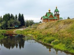
The rocks have always struck the imagination of people with their majestic appearance and bizarre forms. They are compared with the teeth of a dragon, stone forests, bee hives. Throughout the world you can meet "bridge giants". Also original metaphors were invented to characterize remarkable Russian rocks.
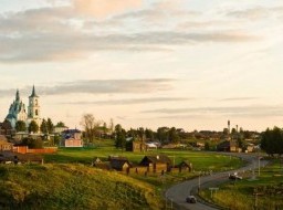
One of the most famous "natural sculptures" of this kind is probably the Devil's Fortress, rocks 25 km from Yekaterinburg, a nature monument of regional importance.
Devil's Town is a majestic rocky crest on top of the mountain of the same name. A 20-meter granite crest is crowned by turrets-remnants. The settlement is located 25 km from Ekaterinburg in the direction of Nizhny Tagil near the station Iset.
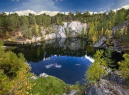
Like the megaliths that look mysterious or mysterious, the Urals are simply strewn. People feel here something incomprehensible, inexplicable to themselves, supernatural. Therefore, similar names of a pond-pond: Devil's Gate, Bloody Finger, Bloody tooth, Devil's Window, Devil's Pass, Devil's Rocks, etc. In the Perm region there is a Stone Town, which is also sometimes called Chertovo fort. The official version of the quaintness of rock forms is the result of erosion, weathering, the impact of water, sun and wind. Or, as in this case, "mattress-like weathering of rocks." Let's try to doubt this.
Or maybe the word "damn" from the "hall"? Flat stones are very neatly stacked on top of each other like cakes. There is a version that someone so amused here 300 million years ago. Although we at least 200 though 400 what's the difference? Scientists say that the origin of stones is volcanic. How can this be? The Ural mountains were once very high, suppose lava erupted, then cooled down, but it did not have time to freeze, and one of them pancakes and piled on top of each other?
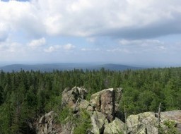
On the way to the Devil's fortress and everywhere there are many such smooth stones 6-8 meters long. They are so lightly sprinkled with earth. In addition, at some distance from the ridge there are small rocky outcrops up to 7 meters in height. However, they dotted all the surrounding mountains, they call us stone tents. The impression that there was something grandiose, but already collapsed, there were only fragments of the wall. On some stones spherical saws, perhaps not natural.
Researchers of this place have suggested the man-madeness of this structure, inexplicable technology and inexplicable designation, but what contradicts orthodox science can not get any wide distribution.
3 It can be assumed that the Devil's fort is the remains of an ancient city. An ancient man-made city, could be surrounded by such a wall. There was a war, colorfully described in the Indian treatises of "Vimani-Kashastra", "Mahabharata", "Ramayana", the action took place here in the territory of the Urals-Siberia. The weapons were devastating in the past civilizations. Vimana is still reactive. In the Urals there are plenty of places where the stones seem to "flow". That is, they were melted, and then froze in bizarre unusual shapes after striking such a nuclear or laser (relatively speaking) but very powerful weapon.
This place was inhabited in later times after those wars of previous civilizations. Often such unusual places were considered sacred, people brought sacrifices to appease the spirits. Archeologists found crockery dishes, some pendants and the ubiquitous pieces of sheet copper. In the Middle and Southern Urals manic melted copper from ancient times.
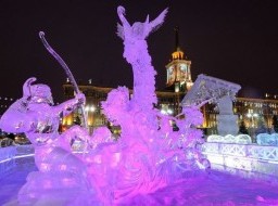
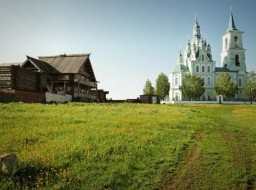
On the Devil's fortress there are always a lot of tourists, climbers, it's great to train here, because the place is accessible. Around the pine-birch forests. Especially all this is beautiful in autumn. This is also a popular holiday destination. Unfortunately, citizens are constantly trying to show that they know the letters and are able to write in the complete absence of culture. The rocks are simply covered with inscriptions. Schoolchildren somehow counted about 1700. And the first for 1902. This greatly spoils the look. At one time the rocks were closed for mass visits from 1980 to 1985. Then the district was cleared of the mountains of domestic garbage. The rocks were then run by the Pervouralsk City Executive Committee. Is someone watching for cleanliness now. I do not know.
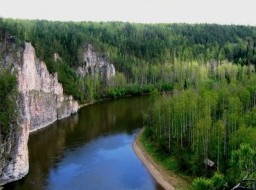
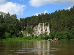
Below, the Semipalatinsk River is the tributary of Iset. Iset is a very interesting river with many rocks, flows into Tobol. This is the Ob basin. Iset, and it would be more correct Iset - the river of the god Iset (Isis). Isis in the hands of the sisters is such a tool, and on top of the image of the cat. The Sysert River (Systre) also flows nearby in the Middle Urals. And ancient figures of cats there were found by archaeologists. Do not think that there is a hint of Ancient Egypt, as if our ancestors of the aria came there as well as to India and Persia and founded a civilization there. This is fundamentally contrary to the paradigm of pseudo-history. We have the RA river by the way. So in ancient times was called Volga + Kama + Chusovaya, taking its source from the sacred mountain of Irius in the Southern Urals.