Kucherlinskoe Lake
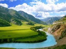
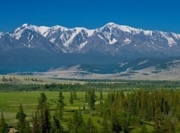
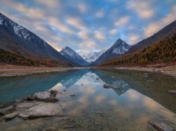
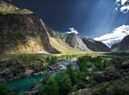
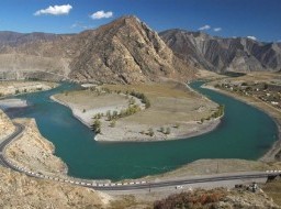
Kucherlinskoe Lake is one of the largest water basin of glacial origin. The lake is located at an altitude of 1790 meters. Eastern and western part of the Lake border on the high peaks (3000 meters), moraines adjoins northern part and narrow valley of Kucherla River borders on south part. Kucherlinskoye (Kadzhur-ly or Kudyurlu – “With soils”) is Lake located at the foot of the northern slope of Katun ridge in the upper reaches of Kucherla River. The nearest town is Kucherla Village and Tungur village. Equestrian trail with length 34 km runs from Kucherla village. Kucherlinskoe Lake fells from the south to the north, and its length is 5220 meters. The average width is 575 meters. The northern part is expanded to maximum width about 900 meters. The basin of the lake was formed by ancient glacier moving, it has trough-shaped form, flat and concave bottom and steep slopes. The maximum depth of Kucherlinskloe Lake is 54.8 meters. The northern part of the lake is impounded by powerful moraine of retreated melted glacier which has carried loose unsorted material such as clay, gravel, pebbles and boulders. Here, at the source of Kucherla River, lake is shallow. On the coastal strip a lot of honeysuckle and cranberries. The shallowest is the northern bay unlike the eastern and western coasts with the depth rapidly increasing. On the right slope of the lake, at an altitude of 2300 meters, one of the most beautiful lakes is located. Blue Lake feeds Kucherlinskoe together with glaciers. Average January temperature on the shores of the Lake is -18 C, July temperature is +11, but night frosts are possible even in July. The annual rainfall is 550 mm. Outskirts of the Lake is subalpine and alpine meadows, often visited by the Siberian mountain goats, which are the objects of hunting and snow leopard (ounce). A grayling live in the lake and Kucherla River as well as trout released into the Lake in 1997. The turquoise color of the water, steep rocky cliffs, forested slopes, all of this combined with the noise of falling water makes unique beauty of the Lake and attracts tourists from around the world. In the morning and in the evening, when the sun rays fall down from certain angles, surface of the Lake mirrors image of blue sky, mountain slopes covered with larch and cedars. Top Kucherla Lake is located in 100 meters above the Kucherlinskoe Lake at an altitude of 1795 meters. It has 480 meters length and 200 meters in width. It resembles an expanded bed Kucherla River. Its maximum depth is about 5 meters, eastern and southern shores are swampy and probably it will become a floodplain of Kucherla River. Kucherlinskoe Lake is part of the territory of the Natural Park "Belukha". |